
West Texas Geospatial Analytics LLC
See Your Fields From Space — Weekly Water Stress Insights
Decades of satellite analysis experience
Data-driven irrigation and crop management insights
No UAVs, no field visits — fully remote analytics
Low-cost, high-clarity geospatial intelligence briefs
* get a FREE updated field water stress report. No signing in. No payment info needed.
Click to explore
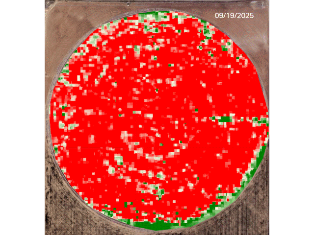
The Composite Water Stress Index (CWSI) is generated by analyzing infrared bands from current and historical satellite observations


Field Monitoring Platform
Monitor your crop, rangeland, park, reserve or any area of interest on a customized frequency with spectral indices derived from near real-time satellite imagery. We process, curate and deliver your data on a weekly basis in an easy-to-interpret one-pager report offering speed + simplicity + affordability.